

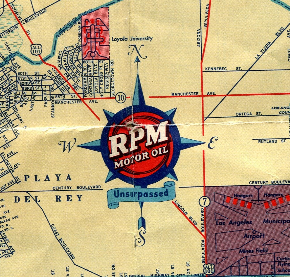
LA looked a bit different then, as you can see. Here's the forerunner of LAX:

Before there were "wetlands," there were "swamp areas." Notice that the marina was not built yet, and the area was home to a gun club!

There were several small airports in the LA area, including one in Culver City

There were also many "blank" areas on the map, completely undeveloped.

Another couple of small airports, the National Guard Airport in the northeast corner of Griffith Park, and the Grand Central Air Terminal just north of that.

Elysian Park and environs, 20 years before Dodger Stadium

The California Zoological Park, and Cawston Ostrich Farm, both in what is now Highland Park. The Ostrich Farm had previously been in South Pasadena.

Note "the other" Wrigley Field, first home to the Hollywood Stars of the Pacific Coast League. The Fine Arts Museum is the precursor to LACMA.The LA Colosseum is only about six years old at this point. USC has grown a bit since then.

More "blank" space on the map.

Gilmore Stadium, at the corner of Fairfax and Beverly, now home to CBS. Also note the famous [Pan] Pacific Auditorium. And a lot more "blank space" all the way down to 6th Street, near "the Fossil Pits."

Another small airport, west of the larger one seen above.

Lots more empty space.
The future location of Beverlywood, a big open area, with the Pacific Military Academy in the middle.

Even more undeveloped areas in Mar Vista.
